For years I've been boasting to out-of-towners, "Portland seems damp, but we only get 37 inches of annual precipitation on average, which is less than most East Coast and Southern cities." For example, Philadelphia gets 42 inches, and most of Florida gets more than 50 inches. In Portland, the rain (and rare snow) is simply spread out over more days. This has been my story. But after a recent conversation and some digital digging, I am concerned that our rain data is suspect - or, at the very least, not representative of the Portland region, or even the city proper.
Saturday, February 25, 2012
Tuesday, February 21, 2012
A whack at democracy in land use
 |
| Suburban and rural Troutdale, Oregon. Photo: author |
Sunday, February 19, 2012
Transit-to-Parking Price Ratio
TriMet, the Portland region's primary transit provider, has been struggling to overcome budget shortfalls for several consecutive years. Just like at almost every other public agency in this nation, the Great Recession blew a hole in TriMet's revenue stream - in this case, the regional payroll tax. Among the agency's proposed solutions is raising fares from $2.10 to $2.50 for a two-zone trip. The proposal would also eliminate fare zones (including Portland's free rail zone), and institute a one-way-only rule (no more quick out-and-back trips). Meanwhile, Portland will continue to have among the cheapest downtown parking meter rates on the West Coast: $1.60/hour.
Thursday, February 16, 2012
My (Threatened) Car-Free Day Trip
Last week, to celebrate one year of getting around fine without a car, I took a day trip. It was an unusual day trip for the United States of America - it involved trains, bike paths and hiking trails instead of cars and interstates. It featured transportation modes that more and more people are using in our urbanizing nation, but that are threatened by Congress. This week, the Republican-led House of Representatives nearly voted on a transportation bill that cut off Highway Trust Fund allocations for transit and bike/ped projects. This would have eliminated a critical funding stream for active transportation projects originally authorized by President Reagan. Fortunately, the bill was so bad, and had so many people from both parties against it, that it never left committee. But Congress may try again in a few weeks.
Wednesday, February 15, 2012
Living in Portland
There have been a number of these going around the interweb lately. So I made one about Portland...


Monday, February 13, 2012
Christie proposes municipal sharing
We here at CityRegionNationWorld don't often see eye-to-eye with Republicans on matters of urban and regional planning. But here's a sensible idea from New Jersey Governor Chris Christie: sharing the cost of services across municipal boundaries.
Wednesday, February 8, 2012
Dead U.S. Routes
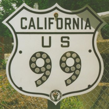 |
| Photo: www.routemarkers.com |
Rent a 1950s vintage Chrysler with tail fins and meet me at the corner of US 99 and US 66.
Can’t find it on Google Maps? That’s because both roads have been lost to history for nearly 50 years. But in case you’re wondering, that defunct crossroads is now the intersection of Figueroa Street and San Fernando Road just north of Downtown Los Angeles.
Monday, February 6, 2012
NYC Energy Use by Tax Lot

This is a remarkable set of data, especially for a city that once gave up on metering water. A logical next step, and one recommended by several who commented on Howard's site, would be to normalize this data by building floor area. In theory, this would reveal which buildings are more efficient, either by massing, weatherproofing or a combination of both. As is, the data shows a strong correlation with building size and height - Midtown skyscrapers at the high end, outer borough townhomes at the low end.
It would be great to see this data for other cities. Thanks to Jessi for sharing via Gizmodo.
Link: http://modi.mech.columbia.edu/nycenergy/
Subscribe to:
Comments (Atom)